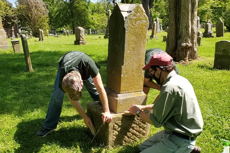
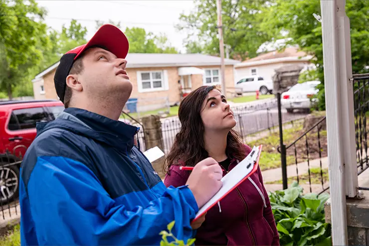
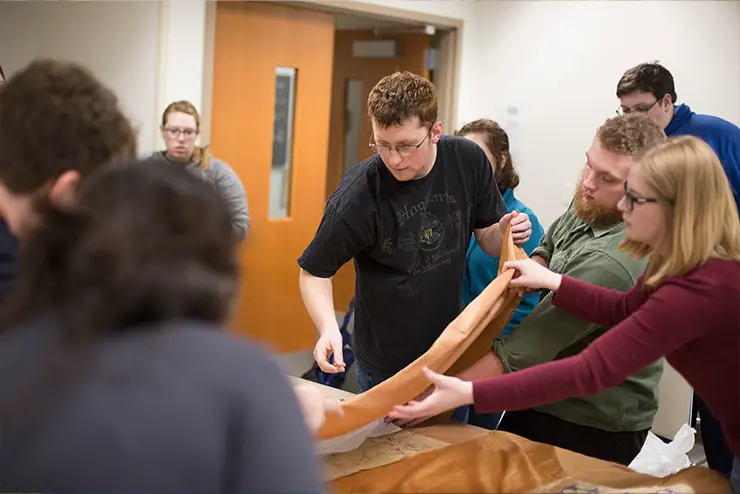
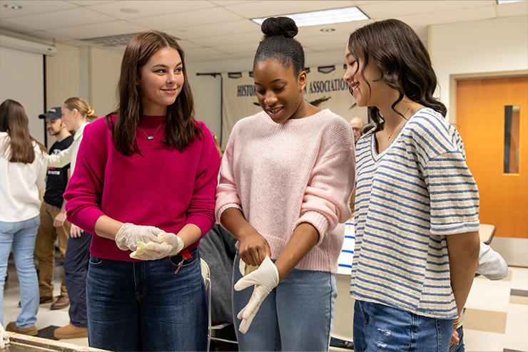
The Bollinger Center for Regional History at Southeast Missouri State University is involved in a variety of public outreach programs which serve to preserve, present, and promote the history of the region.   

The Bollinger Center for Regional History is located on the third floor of Carnahan Hall (Room 301) on the campus of Southeast Missouri State University in Cape Girardeau, Missouri. 

The Center fills many roles both on- and off-campus. We advise and assist students working on scholarly projects focused on the region and present topics of local interest to various classes at Southeast.   

For the broader community, we provide tours and lectures to civic and educational organizations about the history of the region. We also collaborate with local museums and historical societies to promote local and regional history.   

The Center was established at Southeast Missouri State University in 1978 with Arthur Mattingly serving as the director. In 1982, Bob White replaced Dr. Mattingly and, in 1990, Dr. Frank Nickell assumed the directorship. For more than 20 years, Dr. Nickell served as the director and became synonymous with the history of southeast Missouri. In 2013, Adam Criblez, professor of history at Southeast, became the director following the retirement of Dr. Nickell.  

Did you know?

The southeast corner of Missouri extends like the heel of a boot into northern Arkansas. This projection is approximately 50 miles long and 30 miles wide. It contains approximately 2,000 square miles and three million acres. All of Pemiscot and portions of Dunklin and New Madrid counties are in this area. 

It was this section that was most affected by the earthquake of 1811-1812. According to local traditions, prior to the earthquake the area was fertile and promising -- after the earthquakes, wet and swampy. Many people left the area following the tremors, but one who did not was John Hardeman Walker whose family had settled in the vicinity of Caruthersville in 1810, just before the earthquakes. By 1818, when he was 25 years of age, he reportedly owned several thousands of acres and a large number of cattle, all in the area between the Mississippi and the St. Francis River to the west. 

At that time, the territory of Missouri applied to the U.S. government for admission as a state. When the proposed boundary for the new state was drawn it established the southern line at a parallel of 36 degrees and 30 minutes north latitude, an extension of the boundary of that served to separate Kentucky and Tennessee, North Carolina and South Carolina. But such a boundary would leave the people of the Caruthersville area and all of J. H. Walker's property in the Territory of Arkansas, which was, at the time, less organized than Missouri. Consequently, Walker and other residents of the area brought all the political pressure they could muster to move the boundary to the south, creating the Missouri "bootheel." 

The details of exactly how and why this effort succeeded is one of the great stories of early Missouri, shrouded in legend, folklore, and mystery. 

The New Madrid Fault System stretches across southeast Missouri crossing five state lines, the Mississippi and Ohio Rivers. It is an active fault, with many small tremors occurring each year. In 1811-1812 a series of earthquakes, lasting for several months, occurred along the fault. Many of the individual shocks were so severe that they left a lasting impression upon the area, influencing landscape and settlement patterns. The quake which occurred in February of 1812 is reported to have been felt in the entire eastern half of North America. This may have been the most powerful earthquake to have occurred in what is now the United States. 

On the night of January 9, 1939, an exodus of black and white sharecroppers moved across southeast Missouri to camp along highways 60 and 61 south of Sikeston, Missouri. By midnight the "croppers," as they came to be known, had camps south of Sikeston where 60 and 61 cross, and soon there were others near Wyatt, Cairo (Ill.), Charleston, Hayti, Morley, Lilbourn, Caruthersville, and New Madrid. Their numbers have been estimated at somewhere in the vicinity of 2,000. They were making a demonstration and taking a stand, and they were risking much by doing so. Their actions, which preceded the modern Civil Rights movement by nearly three decades, is one of the most significant stories of social unrest in the history of the state. 

As part of the New Deal program of the 1930s, American farmers were granted subsidies to cut farm production. The subsidy checks went to the landowners who were supposed to share a portion of the payment with their sharecroppers, people who performed the farm labor for a share of the farm profits. Many planters, rather than share the subsidy payment, just kept the money or simply cancelled the arrangement with their sharecroppers and moved them off the land. The notification of the arrangement between owner and cropper was usually given in early January. 
 
In January of 1939, many sharecroppers were notified they would not have a place for the coming year. To protest the action, the Reverend Owen Whitfield, a charismatic African American minister, helped organize the sharecroppers to demonstrate their plight to a regional, if not national, audience. They determined to move to the roadside of the most traveled highways in the center of the country, 60 and 61. The event caught local planters and officials by surprise. Photographs appeared in St. Louis and national newspapers, and soon the demonstration was front page news across the nation. Journalists, film crews, and photographers captured the drama of a moment which changed history in southeast Missouri. 

Governor Lloyd Stark and the planters were convinced that the demonstration was the work of communists and outside agitators and had the camps declared a public health hazard. The demonstrators were moved to isolated areas away from the highly visible highways. The strike faded. But, not its impact. Eleanor Roosevelt took up the cause of the demonstrators and wrote about it to a national audience. Whitfield and a sympathetic planter, Thad Snow, of Charleston, Missouri, met with the President. To head off another demonstration, Governor Stark met with Whitfield in 1940, providing an even wider audience for the issue. 

The momentum initiated by the demonstrators established the groundwork for the first significant social service agencies in the Missouri bootheel. The largest of those was the Delmo Housing Corporation, 10 communities for the displaced sharecroppers each containing decent homes with electricity, plumbing, storage space, garden space, and a porch. Started in the aftermath of the sharecroppers' demonstration, the Delmo Corporation continues to this day. 

A recent video entitled "Oh Freedom After While: The Missouri Sharecropper Protest of 1939," tells the story of the protest. The video is available here. 

The Civil War had a significant impact upon southeast Missouri. The presence of Union and Confederate soldiers in the region was very great. Cape Girardeau was the southern-most town held by the Union throughout the war, while Bloomfield was the northern-most town held by the Confederates in the war, although control of it frequently switched. Probably no other town in the state of Missouri changed hands in the war more often than Bloomfield. 

Significant military engagements in the region occurred at Cape Girardeau in Cape Girardeau County; Belmont in Mississippi County; Chalk Bluff in Dunklin County; Island Number 10 in New Madrid County; and Fredericktown in Madison County. 

First, try the USGEN Web Project. This is a nationwide based group of volunteer genealogists. The sites are user friendly, and there are discussion rooms to post your queries. 
 

For individual county contacts try the following: 


The Southeast Missourian newspaper will answer some genealogical queries for a fee. Visit their website. 

The removal of the Native American population east of the Mississippi River was essentially determined by the election of Andrew Jackson in 1828. He was dedicated to that purpose as a measure of progress for the economic development of the new American nation. In his view, the Indian population was "in the way." In 1830 he signed the Indian Removal Act which began the process of relocation to the newly acquired lands west of the Mississippi, some of which were created specifically to receive the relocated people. 

The Cherokee vigorously resisted relocation efforts. They hired skilled attorneys and sued to overturn the law. The case went to the U.S. Supreme Court in two cases, Cherokee Nation v. Georgia (1831) and Worcester v. Georgia (1832). In effect, the results of the cases indicate that the Cherokee won the argument and the court ruled they could keep their lands and stay where they were. President Jackson, however, refused to accept the results, and he and his successor, Martin Van Buren, forced the removal. Seven thousand U.S. army troops under the command of General Winfield Scott forced the Cherokee out of their homes and off their land, placing them in "concentration" camps in preparation for the journey to the western lands. 

The first were moved by steamboat in 1838, under difficult conditions and results. The remaining Cherokee left their camps in late August and early September to travel overland in 16 separate groups. Various routes were taken and, as many of the routes were only used once, they are difficult to document and retrace. Military journals and old newspaper accounts provide basic and sometimes unclear routing. According to Duane King, a Cherokee historian who has helped map the trail, "the trail started at the door of every Cherokee." It ended in Indian territory (now Oklahoma), or tragically, along the trail. The entire trek is referred to as "the Trail of Tears." 

Most of the Cherokee traveled west across Tennessee, southwestern Kentucky, southern Illinois, southern Missouri, and northwest Arkansas. In Missouri, they are known to have crossed the Mississippi north of Cape Girardeau at Moccasin Springs (now the site of the Trail of Tears State Park), slightly south of that location at Bainbridge, and one group south of Cape Girardeau near present-day Scott City. 

From Cape Girardeau the overland groups traveled by different routes in order to live off the land. One route was as far north as Salem, the others were generally across the center of the state, all coming together in the vicinity of present-day Springfield, and from there to Fayetteville, Arkansas and on to Tahlequah, Oklahoma, which became the center of the new Cherokee homeland. 

Crowley's Ridge is the most distinctive feature of the landscape of southeast Missouri and northeast Arkansas. This unique ridge is essentially an upland in the middle of an ocean of land. It is all that remains of once vast uplands that were as high as the Ozarks to the West. During the last glacial period there were enormous meltwaters that scoured this region. Crowley's Ridge, for a variety of reasons, survived this massive erosion, and remains today as testimony that something major happened here. 

In that ancient time the great trough of the Mississippi was west of the ridge, the Ohio on the east. Eventually the waters of the Mississippi cut through and joined the Ohio, the two rivers becoming one, and they moved east of the ridge. 

The scoured troughs on either side of the ridge absorbed the water that came from the watersheds of the north, forming the greatest swamp or wetland in North America when this region was settled by Europeans. Since that time Crowley's Ridge, named for Benjamin Crowley, one of the first European residents of the ridge, has been the highway through and focal point of the historic and cultural life of the region. 

Crowley's Ridge begins just below Cape Girardeau and extends south to Helena, Arkansas. Although it averages only three to twelve miles across, its height, up to 300 feet above the flat lowland, makes it the most prominent feature of the landscape of the Mississippi Valley from Cape Girardeau to the Gulf of Mexico. Today it is the home of small farms, extensive pasture lands, orchards, county seats, sand and gravel quarries -- the source of much of the kitty litter produced in America. The isolation of the ridge made it the refuge of a number of plants that are now identified as endangered. 

The ridge continues to play a vital role in the region. And, that role is diverse. For some it is important for the peaches it produces. For others it is important as a transportation route. For all, it is a source of history and culture. 

The high point on Crowley's Ridge, three miles west of Malden, is known as Riddle Hill. Highway J goes over the top of the ridge in front of the former Van Tompkins home and Peach Orchard. This high ground was named for early members of the Riddle family who settled there in the first half of the nineteenth century. The Old Riddle Cemetery, the resting place of several of these early settlers, existed along the side of the road at the top of the hill until it was leveled in the 1970s. 

The first Riddle to live on the hill was John Riddle (1828-1904). He and his wife, Joeller Beckwith Riddle (1831-1896), purchased 80 acres there on May 2, 1857. The land had previously been owned by Given and Louisiana Owens. Additional property gave John and his descendants a significant location on the top of the ridge. John moved into southeast Missouri with his parents, George and Sarah Hale Riddle, sometime in 1848. The original farmstead was southwest of Bernie on the Stoddard and Dunklin County line. 

John and Joeller Riddle became prominent residents of the region, actively involved in the work of the Bethany Baptist Church. John, Joeller, and their son Robert with his wife, Safronia Jane Tompkins-Riddle, are among the first burials in the Old Riddle Cemetery. 

The Little River Drainage District is the largest drainage district in the United States. It was formed in 1907 by private landowners who sought to drain the Missouri "glades," the largest wetland in the nation, consisting of approximately two million acres of swampland and forest. Today the nearly 1,000 miles of ditches collects the water from seven counties, and 1.2 million acres and moves it into the Mississippi River near Helena, Arkansas. Before the land was drained only 10 percent of the area was suitable for agriculture and residency. Currently, 96 percent is clear and water-free year round. The ditches and levees were constructed in approximately 50 years, the largest land transformation in the world. 

Between November 20 and December 12, 1803, the Lewis and Clark expedition, the Great Corps of Discovery, moved against the current of the Mississippi River to reach their winter camp near St. Louis in preparation for the great adventure which opened the American West. From Cairo, Illinois to their Wood River winter camp they faced 180 miles of the powerful current of the Mississippi. This challenge was greater than they anticipated, leading them to enlarge the size of their crew. 

Members of the crew first stepped on the western bank of the Mississippi in Mississippi County, Missouri, stopping at Tywappity Bottom; Cape Girardeau; a campsite north of Cape Girardeau (possibly on the Illinois shore); at some point in Perry County, possibly Brazeau Creek; Ste. Genevieve; and on to the winter camp near St. Louis. From that location, in the middle of May, the Great Corps of Discovery headed up the Missouri River to the Pacific Ocean. 

Location
Mailing Address
One University Plaza, MS 2960 
Cape Girardeau, MO 63701